Frequent and intense fires in miombo woodlands elevate its potential to impact climate change. Fires in the miombo directly result in GHG emission, thereby suppressing the woodland’s potential to mitigate carbon emission through the mortality of plant species, reduction of forest growth rate, and upsetting the entire equilibrium of forest ecosystem mainly through plant species biodiversity loss.
This study aims to access the potential of miombo woodland fires in Mozambique to increase climate change. Specifically, the study aims to:
- Compare tree species diversity within regions affected by different fire frequencies;
- Assess natural regeneration mortality, species dynamic and structure after annual fires;
- Determine biomass consumption rates (COMF) during early and late dry season fires and;
- Estimate GHG (CO2, CH4, CO) emissions during early and late dry season fires.
The study is being conducted in the Central Region of Mozambique within the Levasflor Concession area where Miombo Fires are more frequent and intense. Data collection started on early July 2022 and ended in mid-October to cover the early and late dry seasons when fires normally occur.
The methodology of the study included 2 experiments. The first experiment aims to Compare tree species diversity within regions affected by different fire frequencies (objective no 1), and the second experiment aims to Assess natural regeneration mortality, species dynamic and structure after annual fires; Determine biomass consumption rates (COMF) during early and late dry season fires and; Estimate GHG (CO2, CH4, CO) emissions during early and late dry season fires (objectives no 2, 3, and 4).
The first experiment consisted of the Identification of 3 Forest fire categories based on MODIS (Moderate Resolution Imaging Spectroradiometer) sensor fire frequency covering fires from 2001 to 2021 (see Fig 1). Forest fire categories (Low, moderate, and High) were considered clusters and in three sites (Condue, Nhaminha, and Massiaboza) 10 temporary sampling plots of 10X10 m were established for each cluster. In total 90 plots of 10X10m were established, 30 for each site. Within the plots, species were identified, and dbh (diameter at breast height) and height for species with dbh more than 2cm were registered. In addition, soil samples and topographic features of the plot were also registered. Within the plots of 10X10m also species with less than 2cm of dbh were counted using subplots of 1X1cm stablished in the center, and corners of the plot(Fig. 2). To correctly identify the species a field guide was used. For those that the field guide could not help, specimens were collected for later identification at the National herbarium from Mozambique Agricultural Research Institute.
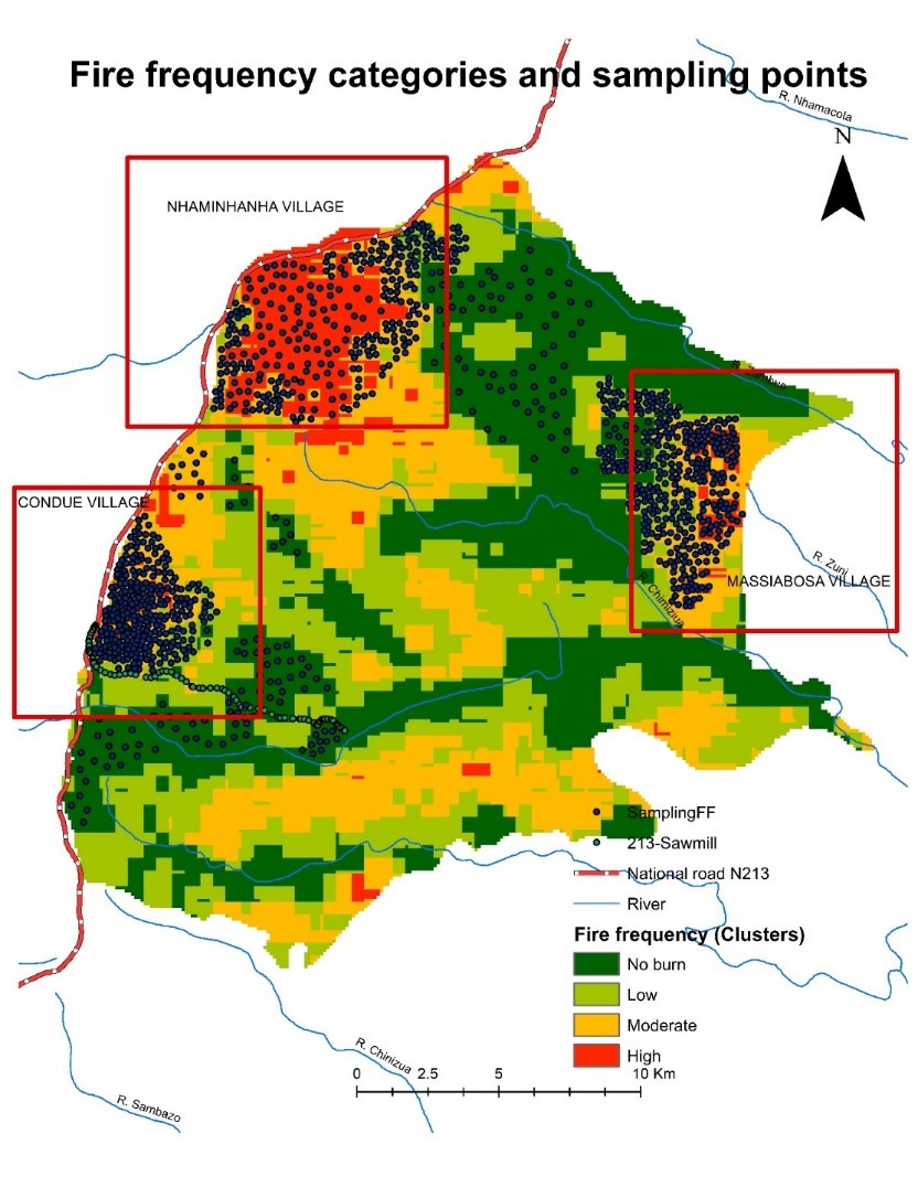
Figure 1. Fire frequency Map and scattered sampling points
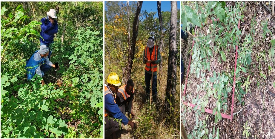
Figure 2. PhD student with SUA supervisor and local guide counting plant species with dbh less than 2cm within subplots of 1X1m
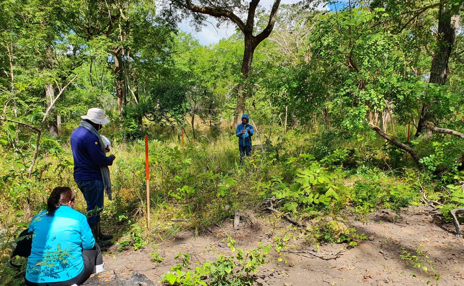
Figure 3. Establishing a plot of 10X10m with SUA and SLU supervisors
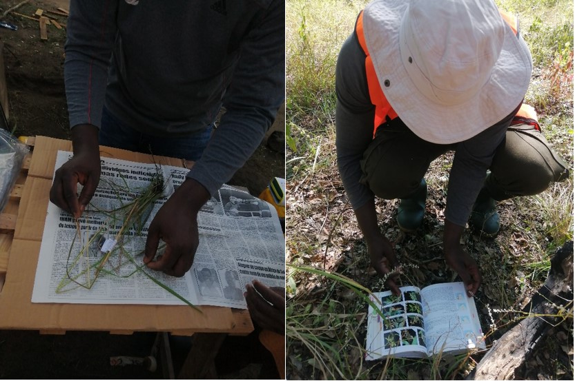
Figure 4. PhD student using field guide to identify species and pressing specimens for unidentified species
The second experiment consisted of permanent plots of 30X30 divided into 9 subplots of 10X10m. Experiments were established in three types of miombo, Dense, medium, and open miombo, and replicated for 3 sites (Condue, Nhaminhanha, and Massiamboza). Three treatments were applied randomly at each experimental site. Treatment includes Early burning, Late burning, and No burning. Parameters collected included: Sensus of species Mortality before and after Treatment (early/late burning), Necromass weight before and after treatment (early/late burning), Meteorological data (wind speed, Relative humidity, Temperature) before and treatment (early/late burning). Complement data included elevation and soil samples of each experiment site.
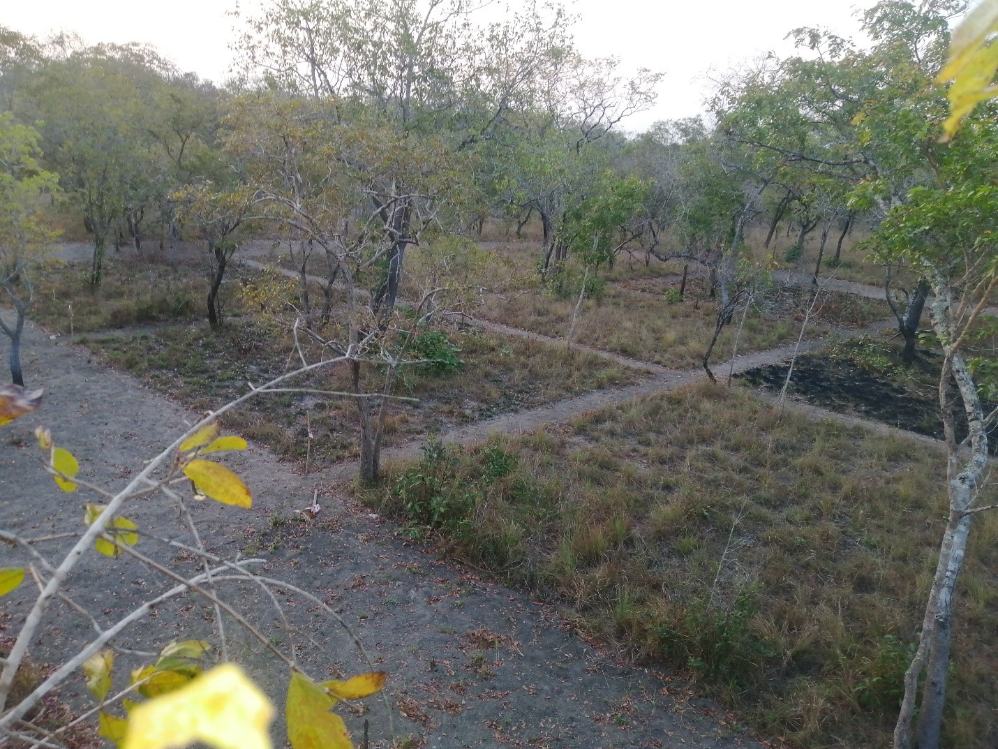
Figure 5. Experimental plot established in open miombo in Condue
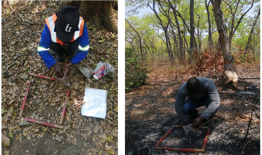
Figure 6. PhD Student and Field assistant collecting necromass (dead leaf) before and after late burning in the medium cover miombo in Massiamboza
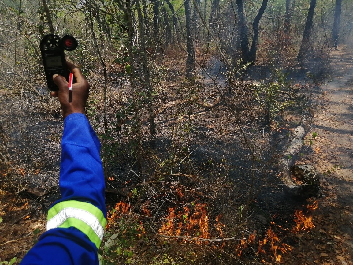
Figure 7. Field assistant collecting Meteorological data during late burning using Kestrel 5700 device
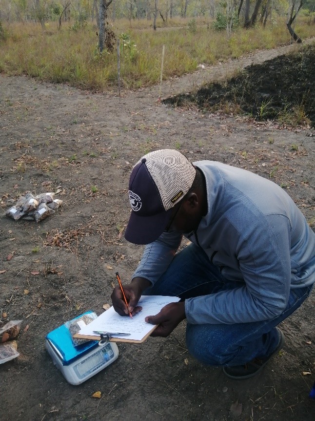
Figure 8. PhD student weighing necromass samples from before and after burning
Conclusion
From Early July to Mid-October 2022 data collection was conducted in miombo woodland located in the Center part of Mozambique specifically within Levasflor concession area. For natural burning experiment (first experiment) were collected data in 90 temporary sampling plots representing three clusters, 10 plots for each cluster and replicated for 3 sites (Condue, Nhaminhanha, and Massiamboza). For this experiment over 250 necromass samples in 3 types of forest (low, middle, and high-density forest) and 90 compound soil samples were collected, collected several specimens for species identification, recorded meteorological data and topographical data (altitude) were also registered.
The second experiment was based on Completely Randomized Block Design. Each type of miombo forest based on a percentage of canopy cover (dense, medium, and open) were considered blocks, treatments included Early, late and No burning. This experiment was replicated in three sites (Condue, Nhaminhanha, and Massiamboza); Data is currently under laboratory analysis to follow the further steps of research.